Places worth protecting: Canada's natural landscapes

Looking out off Round Top, QC (Photo by Eric Tschaeppele)
Planning is a cornerstone of effective conservation. The Nature Conservancy of Canada (NCC) has an immense responsibility to both our donors and to nature to invest in the right places, at the right time, and for the right reasons. To ensure we are directing conservation funds to the most important habitats and wildlife, NCC has developed a simple but effective conservation planning framework that guides all of our work. This framework follows the Open Standards for the Practice of Conservation, and guides how we identify priority areas and manage our properties.
Finding priority places
From 1999 to 2007, NCC completed ecoregional assessments (conservation blueprints) across southern Canada. These provided an inventory of the species and habitats from each region, mapped existing conservation lands and identified priority places where more conservation work is needed.

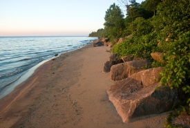
Shore of the Middle Point Woods property, Pelee Island, Ontario (Photo by Sam Brinker, OMNR)
Many of these were places where NCC was already working, such as the Western Lake Erie Islands, but these assessments also identified priority places where NCC needed to act. These ranged from highly fragmented landscapes, such as in Montreal’s Greenbelt, to wilderness areas where we still have the opportunity to protect habitat for large, wide-ranging mammals, such as grizzly bear, in places like the Elk Flathead in BC.

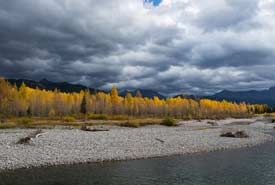
The Wigwam River on Mt. Broadwood, in the Elk Valley Heritage Conservation Area. (Photo by Lyle Grisdale)
NCC then developed Natural Area Conservation Plans (NACPs) for more than 75 of these key areas across Canada. These NACPs identify the species and habitats that make a place important, and which NCC needs to protect.
For example, in the tall grass prairie of Manitoba, our NACP has identified native grasslands and globally rare species, such as the Poweshiek skipperling and western prairie white-fringed orchid, as key habitats and species to invest in.
After an analysis of threats to these important species and habitats, and looking at existing conservation efforts, NCC then maps out the best places to conserve for species and habitats, and identifies other actions we can take to help protect them.

NCC’s Tall Grass Prairie Natural Area protects Canada’s only population of endangered Poweshiek skipperling. (Photo by NCC)
These NACPs are "business plans" for biodiversity and are regularly updated. The maps that identify priority properties and actions outlined in the NACP are what our team uses to explore opportunities for conservation with landowners and local communities.
Managing our properties
Once a property identified as a priority in the NACP is secured, work begins for our stewardship staff. As a first step, all newly acquired NCC properties undergo a detailed baseline inventory. This inventory includes the wildlife and vegetation communities found on the property and also any human-made features, such as trails, old buildings and even archeological sites.
Following the same Open Standards process as for NACPs, we then identify the most important species and habitat to protect, and the key threats, issues and priority actions we need to take.
In some cases, Property Management Plans (PMPs) will identify that few actions are required, and the property and its special features are simply monitored on a regular basis. On other properties, more active management may be required to maintain important species and habitats. These actions can include removing invasive species, restoring wetlands or even reintroducing rare species to support their recovery efforts. For properties with public access, such as Nature Destinations sites, the management plan also identifies how visitors can enjoy these places without impacting the property.
Adapt and improve
One of the key steps in NCC’s conservation planning framework and the Open Standards is the concept of adaptive management. In a dynamic world, it’s critical that we review the effectiveness of our actions on a regular basis and be ready to change them. For this reason, our NACPs and PMPs are updated on a regular basis so we can adapt our actions. New approaches may be needed for a variety of reasons, such as the discovery of new species at risk, a proposed development that could threaten a rare habitat, or engaging a local community group that can help out with property management.
Limited funds for conservation also mean that it’s important to have a conservation community that shares experiences and best practices. For this reason, NCC staff are increasingly sharing the results of our planning and management work in reports, journals and at conferences.
What’s next?
NCC is exploring how to expand our conservation planning framework to other regions of Canada and how we can continue to make it more effective. For northern Canada, where many lands are managed by Indigenous communities and many options for conservation still exist, NCC is developing Nature Atlases. These atlases are intended to provide accessible, science-based information that can support local conservation planning efforts.
In southern Canada, NCC is using new national-scale information on habitats and species to identify priority places. This conservation assessment will be used to refine the boundaries of NACPs and highlight other important areas for conservation.

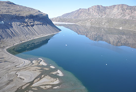
Pond Inlet, Lancaster Sound, NU © Parks Canada/Diane Blanchard
Nature needs us to focus on priorities. NCC’s conservation planning framework ensures our work is targeted to priority places and actions. This ensures there are no random acts of conservation, and the places we are protecting today will be here tomorrow.
This post originally appeared on Places Worth Protecting, a special Globe and Mail microsite produced in partnership with TELUS, which explores how NCC uses the best-available science to help identify the places where it should work. To learn more and enter our photo contest, click here.


