Places worth protecting: The Canadian prairies

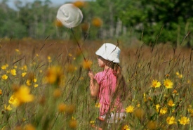
Prairie Day event, Manitoba (Photo by NCC)
So you’ve decided to conserve biodiversity. This decision may lead to many false starts, disappointments and re-negotiated deadlines, but ultimately and eventually, it will lead to land conservation!
Now, how does the Nature Conservancy of Canada's (NCC's) Saskatchewan Region make the conservation magic happen?
It all starts with a landowner. What’s important when we look for land to conserve in the prairies is that it hasn’t been ploughed up, which is no small feat, let me tell you. Maybe the little slice of prairie or forested heaven wasn’t in a convenient place for clearing and cultivating, or maybe there were too many rocks and the landowner thought, “Why bother?”

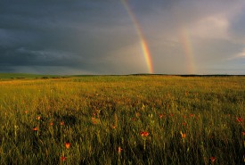
Saskatoon Prairie Natural Area, Saskatchewan (Photo by Branimir Gjetvaj)
Who knows, maybe the landowner manages a bunch of cows, is about to retire, and wants to make sure this little bit of unbrokenness in a province full of straight lines and grid roads continues to stand out as a refuge for all the birds, deer and foxes in the prairies.
I’ve talked to many conservation-minded people about their dreams to see their land, often the land they grew up on, protected for the long term. They tell me their own stories of why conservation is important, and why it is important to them. And they’re always good stories to hear.
By the time they’re done, I’m wrapped up in the story and I want to help too. So after I’ve gone over with them the differences between a conservation agreement and a fee-simple project, I check and double-check their legal land description. "Did they say west of the third?” I am often surprised by how difficult it is for me to correctly hear the necessary set of coordinates over the phone, and I have to figure out exactly where the land is on the map.

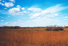
Giant hyssop, tall grass prairie, Manitoba (Photo by NCC)
There are some pretty solid rules we need to follow to make sure our partners, such as the federal government, U.S. Fish and Wildlife Service and Saskatchewan Wildlife Federation, know that we’re efficiently spending the money they gave us. There’s something called a Natural Area Conservation Plan (NACP) that NCC’s science and planning team worked hard to create for parts of the province that are designated as a Natural Area. Part of that plan takes all of the conservation goals and strategies for an area and tempers them with the latest research and expert opinions of the scientists, land managers and interested public. One of the end results of the NACP is a map where I can check to see if the parcel of land fits in with what is outlined in the NACP — whether it would best contribute to the overall biodiversity conservation of the area.
When a piece of land fits our criteria and the land owner, and when our conservation operations team and I have decided between a fee-simple project, which transfers all property rights to NCC, and a conservation agreement, where the land owner retains a portion of the property rights, but a set of agreed-upon property management restrictions stay with the property in perpetuity, then the real work begins. At least, it feels like real work when you are sweating your way up first hill or past another thorny bush, carrying all of your gear and cataloguing all of the species you can see as well as any buildings, fences or old rock piles you know will go into the report that describes the project. But that set of headaches is for another day.
This post originally appeared on Places Worth Protecting, a special Globe and Mail microsite produced in partnership with TELUS that explores how NCC uses the best-available science to help identify the places where it should work. To learn more and enter our photo contest, click here.


