Harnessing technology for conservation: A new era for Canada's ecosystems

St. Peters Harbour (Photo by Jenna Rachelle)
The Nature Conservancy of Canada (NCC) is reimagining the use of technology to address current and future conservation challenges. Through its Conservation Technology Strategy program, NCC leverages data-driven methods to enhance decision-making and foster healthy landscapes for future generations.
Innovative tools for informed decision-making
With funding from RBC Foundation, NCC worked alongside Carleton University researchers to develop a conservation planning tool kit to empower conservation efforts across Canada. During development, the tools were also adapted to meet the needs and values of Environment and Climate Change Canada, Indigenous land managers and local land trusts. NCC's conservation planning tools aim to revolutionize conservation decision-making. These tools help identify priority areas for conservation by considering species at risk, critical habitat, cultural values and cost-effectiveness.
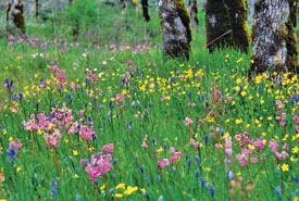
Cowichan Garry Oak Preserve,BC (Photo by Tim Ennis/NCC)
The toolkit includes three main tools: Where To Work (WTW), What To Do (WTD) and Landscape Resilience (LR). These tools use artificial intelligence and computing power to conduct real-time conservation analysis and compare multiple scenarios, incorporating complex data such as species distributions and climate change projections. This comprehensive analysis helps identify priority areas and effective strategies for protection measures and land stewardship.
The Where To Work and What To Do tools are open-source and available for use by government organizations, land trusts and the public through the Sites digital platform.
Empowering conservation efforts across Canada
With funding from RBC Foundation, NCC has made significant progress using the Where To Work tool for large-scale planning. Analyzing different scenarios, this tool identifies several priority areas for conservation that help inform NCC’s national and provincial strategies and ensure optimal conservation impact.In Alberta's Aspen Parkland-Boreal Fringe, NCC staff using the WTW tool identified 20 percent of the landscape as a priority conservation areas, guiding strategies to protect and maintain the resiliency of these lands.

Great Grey Wildland, AB (Sean Feagan/NCC-CNC)
Optimizing conservation actions
The What To Do tool assists in determining the best conservation actions to take within priority areas, evaluating stewardship activities such as installing fences or removing invasive species and assessing the potential impacts of these actions. This allows conservation practitioners to choose the most effective conservation actions to take to protect biodiversity and ecosystem services.
Currently a prototype, the Landscape Resilience tool is designed to evaluate the resilience of different landscapes or project areas to help support decision-making in optimizing the contribution of conservation efforts to landscape resilience and nature’s ability to thrive. The LR tool helps identify areas that are resilient yet unprotected, making them prime candidates for area-based conservation efforts. It also assists in identifying degraded areas where restoration activities could provide significant benefits.
Inclusive and data-driven conservation planning
These tools are user-friendly and accessible to government agencies, land trusts, non-profits and Indigenous communities. By providing evidence-based decision-support, they help organizations prioritize resources and actions effectively.
With support from RBC Foundation, NCC's innovative approach makes conservation planning more efficient, inclusive and data-driven.
To learn more about RBC Foundation’s support of Nature Conservancy of Canada, visit RBC.